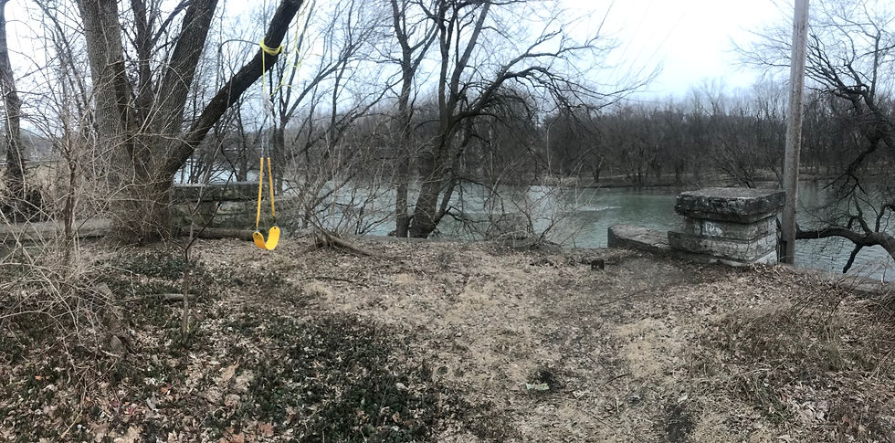
This past weekend I went for a trail run along the top of the White River levee in the Warfleigh neighborhood (southside of the river), north and south of the Kessler Avenue Bridge. After turning around at College Avenue and on my way back to my car (I parked at Friedman Park), I stopped to investigate a stone structure I had seen while fishing and kayaking in the river. On the Warfleigh side of the levee, this location is at the intersection of 64th St. and Riverside Drive.

The stone structure is actually the southern abutment of a long demolished bridge over the White River. The bridge pre-dated the bridge which would be built to carry Meridian Street across the river just downstream and to the west of the Warfleigh Bridge.

I could go into detail about the Warfleigh bridge, but an excellent post on Historic Indianapolis a few years ago covered the history of the Warfleigh neighborhood and the bridge. Check out the link to the post for some more background information and additional photos.
Back to my own survey, the panoramic below is looking north towards the Penn Arden neighborhood. The road deck for the bridge would have run in between the two stone pillars on the left and right of the photo (note the pillars are visible in a photo near the top of the Historic Indianapolis post). If you look closely, you can see a notch in the wood line on the opposite shore which marks the route of the bridge and the road. The road itself terminated at the present day southeast corner of Meridian St. and Arden Dr. A parking lot presently sits at that location.

I want to say there is a matching abutment on the northern bank, but despite running the trails back in that area, I honestly cannot remember if there is or not. The remains of the foundation for the single mid river pier which supported the bridge can be seen during low water. If it is very low, the foundation will sometimes be completely dry, but is usually just under the surface, yet clearly visible.

Comments