A Glorified Sandbar: The History of Governor's Island in Indianapolis
- Ed Fujawa
- Feb 27, 2023
- 6 min read
A recent Twitter post about the future Indy Eleven soccer stadium, and the old city cemetery which once occupied the proposed location, resulted in a question which has occasionally popped up online: What is the story with Governor’s Island, the island which appears just to the west of the cemetery in the Twitter post linked above.

Governor's Island was located in the White River, south of Washington Street, and just north of Kentucky Avenue, and makes regular appearances in maps of Indianapolis during its first 100 years as a town/city. But the story with the island isn’t terribly glamorous and is simply that the island was there, and now it is not. The earliest maps found showing the island is the 1821/22 surveys of Marion County, where the island, unnamed on these surveys, is situated just to the west of the Indianapolis “donation," or the Seat of Government in the map below. In this map, the horizontal line just north of the island roughly follows the route of Washington Street, while the "G" in government is close to the intersection of Illinois and Washington Street.

The first map I located which includes the “Governor’s Island” name is the 1836 Sullivan map of Indianapolis. However, there are two versions of the map, both in the digital collections of the Indiana Historical Society. One is a ‘manuscript’ version (accessible here) where the island is unnamed. The second is a ‘published' version where the island bears the name “Governor’s.” From this map, it appears the island was once part of a bend in the river, before a small channel was cut through the bend, creating the island.

The island continues to appear on maps in the years after 1836, although it's not always named. The 1852 Munsell map (below, left) labels the island as simply “Island,” while the 1866 Warner map (below right), which was featured in the Twitter post above, does label it as “Governor’s Island.”


Left: Munsell Map of Indianapolis, 1852, Indiana State Library Map Collection. Right: Warner Map of Marion County, Indiana 1866, Indiana State Library Map Collection.
But little mention is made of the island, whether a description of its location, or being identified as “Governor’s Island” in written sources. Berry Sulgrove, in his History of Indianapolis and Marion County, published in 1884, provides some of the most descriptive information about the island. Sulgrove describes it as “a low sandy island, containing a couple or three acres, and covered with large sycamores and elms, called ‘Governor’s Island.’”
Over a decade before Sulgrove’s history was published, John H.B. Nowland references the island in his Early Reminiscences of Indianapolis, published in 1870. Nowland describes early efforts at farming in Indianapolis in 1821, and notes that residents from the surrounding area would take their horses “to the island just across the river from the old cemetery to graze” on Sundays. Per Nowland, the island was full of pea vine and other “good pasture” which was a treat for the horses after a work week. However, he also reported that a panther or catamount was known to prowl the island, and the animal’s “halloo” could be heard at night, sometimes dissuading residents from grazing their horses on the island. Notably, Nowland does not refer to the island as “Governor’s Island,” although its proximity to the cemetery seems to make it a certainty that he and Sulgrove are describing the same island. The wildlife on the island is also referenced by Jacob Piatt Dunn, in his history of Indianapolis, where he makes a passing comment about a large bear seen on Governor’s Island.
I found no references to anyone residing on the island, although I suspect temporary residents were possible. Some references in newspapers and city histories mention a grist mill on the island, although I found no evidence of industry. The mill seems to have been located on the western bank of the river, and utilized the river's flow around the island, and into the bayou area which used be present on that side of the river.
The source of the "Governor's" name is uncertain. Perhaps some nod to the governor of the state of Indiana, or an attempt to mimic a notable feature farther east, Governor’s Island in New York City. But its history has not been as permanent as its possible namesake in New York. As described by Sulgrove, the island was low and sandy, which paints a picture of a glorified sandbar. The Indianapolis Journal made a similar observation in 1885, describing Governor's Island as "a low, heavily timbered, weed-covered, sandbar...".
Readers of this blog may recall past posts about the White River, and how it's generally shallow nature and frequent sandbars made any serious commercial navigation difficult. Additionally, frequent floods, or freshets, had the tendency to shift the river’s course, whether or a period of years, or over the course of a few days. At the time Sulgrove wrote his history of the city he noted that Governor’s Island “had entirely disappeared," an observation shared by the Journal in 1885. He also described that flooding had cut away at the east bank of the river where the city cemetery was located and shifted the main flow of the river to the east of the island. As a result, “that once conspicuous feature is merged in the broad low sandbar that fills the old bed.” This seems to suggest that at that time the island was merged into a new west bank of the river.
Despite reports of its demise, the island continues to make appearances on maps of the city well into the 1890’s and past the turn of the century. I have not found photos of this area of the river during this time (if you have any, let me know!) but I think these later maps may be evidence of two things: Lazy map makers referencing back to older maps without being on the ground of the area they were mapping, or the part of the White River where Governor’s Island was located continued to be the site of intermittent sandbar islands, depending on the conditions in the river. The maps below are from 1889 (left) and 1910 (right). Governor's Island still appears in both, although much smaller in 1910, and not named in either map. Casting further doubt on the accuracy of the 1910 map is that the old National Road bridge over the White River is still shown, even though it was demolished in 1902-1903.


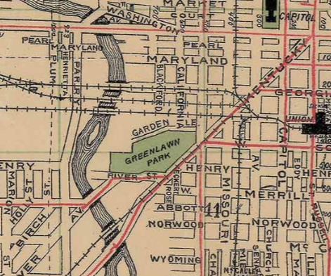
Left Map: Atlas of Indianapolis and Marion County, Indiana 1889, Indiana State Library Map Collection. Right Map: Mendenhall's new index map of greater Indianapolis 1910.
Looking at this section of the river today in an effort to find signs of the old island is an exercise in futility. The natural changes in the river, and the massive amount of channel work and flood prevention construction done in the river through the downtown area has changed the river drastically over the past 100+ years. Aerial photos did not arrive on scene until the 1930's, and the 1937 aerial for Indianapolis shows the eastern shore of the river includes a broad, possibly sandy or rocky expanse, with a narrower channel to the west.

The image below shows where the island would have been today. The location of the old cemetery and the now defunct Diamond Chain complex (along with other industrial operations) are in the background, just beyond the wooded east bank of the river. While there is a small sandbar present in the river, this is not the original island, and the size of the sandbar varies depending on the water levels. But perhaps we can dub this Governor’s Island Redux.

Sources
*Thanks to DeeDee Davis for helping identify some of the sources for this post*
Atlas of Indianapolis and Marion County, Indiana (1889), Indiana State Library Maps, https://indianamemory.contentdm.oclc.org/digital/collection/p15078coll8/id/1610
Warner Map of Marion County, Indiana 1866, Indiana State Library Map Collection by way of Library of Congress, https://www.loc.gov/item/2013593173/
Munsell Map of the City of Indianapolis and its Environs, 1852, Indiana State Library Map Collection, https://indianamemory.contentdm.oclc.org/digital/collection/p15078coll8/id/3755
Sullivan Map of Indianapolis, 1836, published version, Indiana Historical Society, https://images.indianahistory.org/digital/collection/dc035/id/269/rec/3
Sulgrove, B. R. (Berry R. 1828-1890. (1884). History of Indianapolis and Marion County, Indiana.
Dunn, J. P. (1910). Greater Indianapolis: the history, the industries, the institutions, and the people of a city of homes, Vols. 1-2
Nowland, John H.B. (1870) Early reminiscences of Indianapolis
Indianapolis Journal: April 5, 1885, February 5, 1888